


The Marmoraton Mine
An open pit mine now transformed into a big deep lake

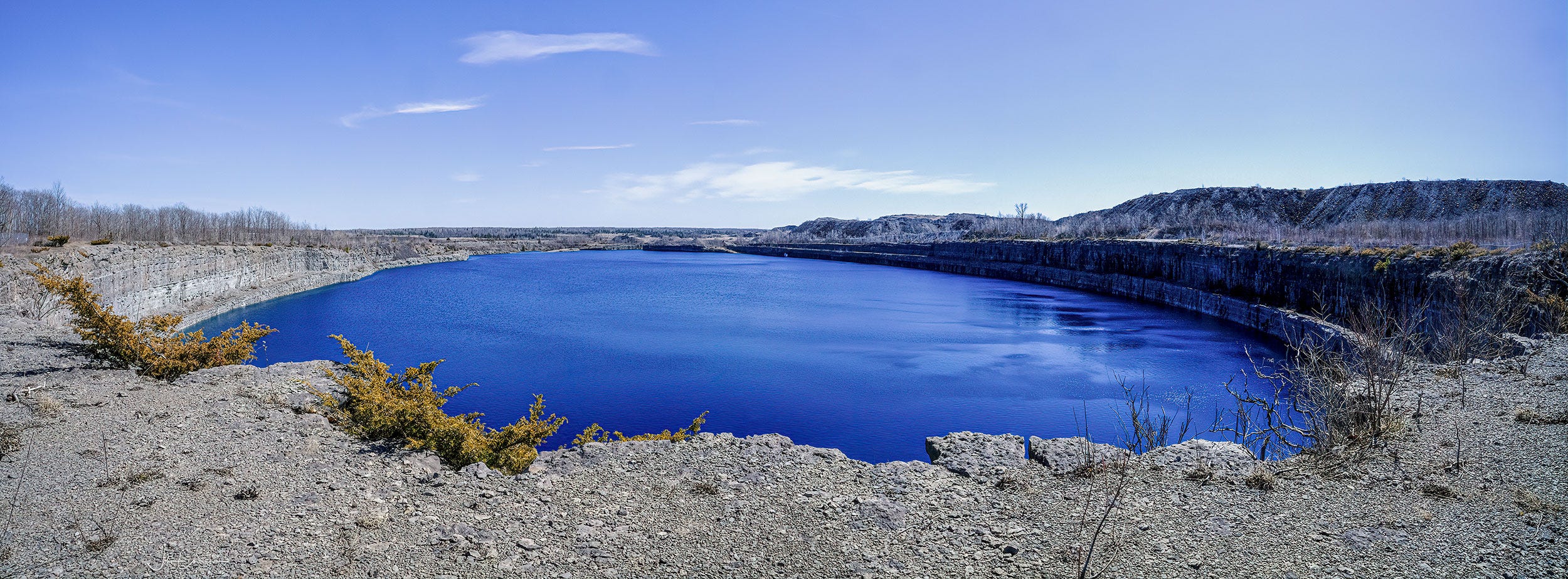
This week, I visited an abandoned open pit mine on the outskirts of the town of Marmora, Ontario. The mining site is actually still active, but the big pit was closed down years ago. The 700 foot basin has since filled up. This is what it looked like on Thursday when I dropped in with a friend. The day was sunny and warm, the first in a while. Temperatures were finally pushing 20 degrees after a spell of cooler than normal weather.
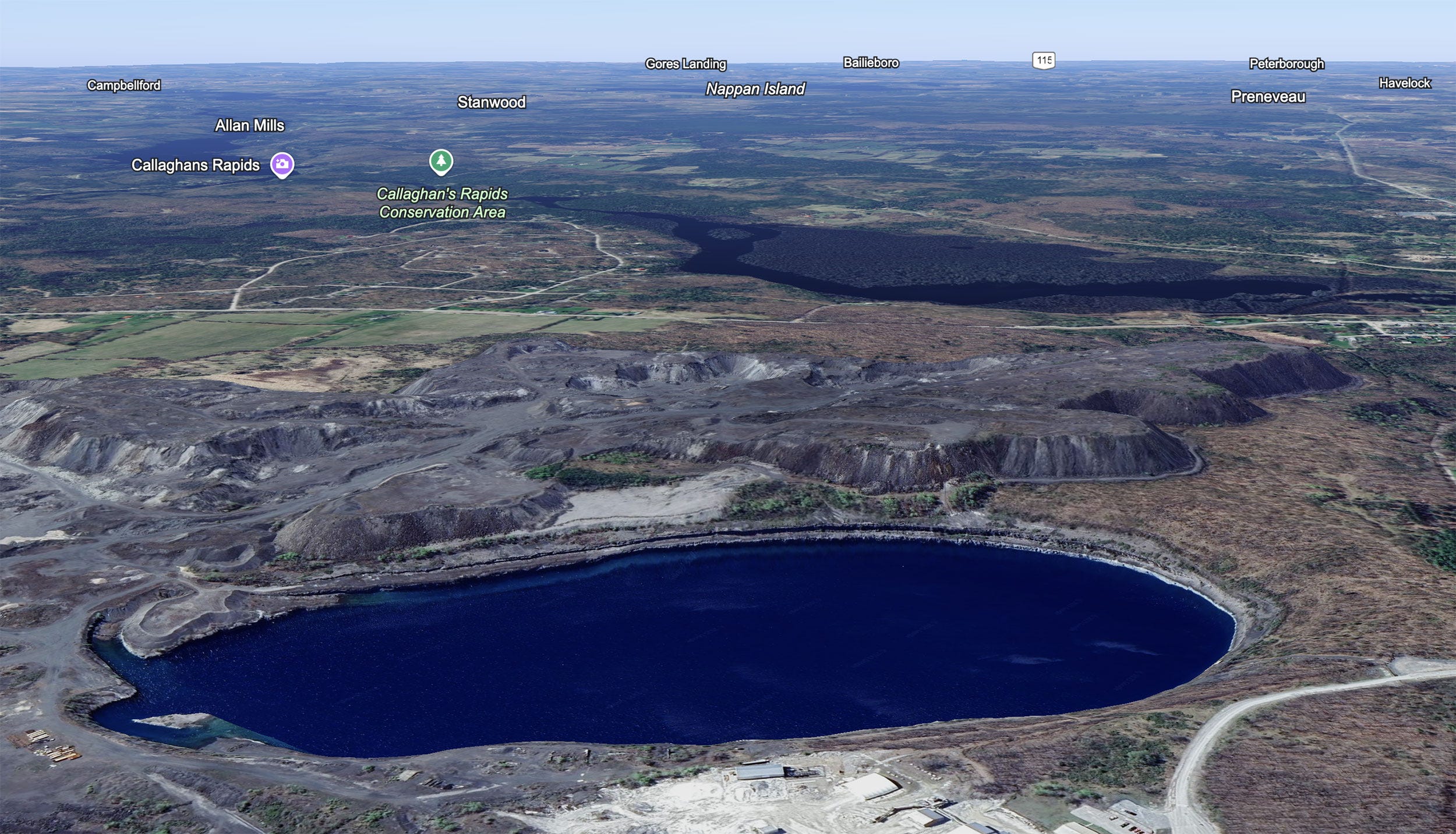
The mine sits just east of the town of Marmora. Bellow, a Google Earth image looking southwest shows the mine in relation to Campbellford (top left), Gores Landing and Bailieboro identify Rice Lake (top middle) and Peterborough (off in the distance top right). The river in shadow is the Crowe which runs through Marmora just on the right. The road leading to Havelock and Peterborough is Highway 7.
The pit is massive; about 75 acres. In fact, it is so big it’s hard to photograph in a single go. My widest lens, a 13mm (20mm full frame) could not take it all in. The panorama at the top of the post was made by stitching four wide angle images each one overlapping it’s neighbour by at least a third to create a single ultrawide view .
History of the Marmoraton Mine
A large body of iron ore was discovered here in 1948 during an aeromagnetic survey of the area. The ore lay 130 feet down under a massive layer of limestone. The decision was made that strip mining was the safest and most cost effective way to excavate the magnetite ore body. Stripping the top layer off started in 1953 with the first ore pellets being railed to Picton in 1955 where it was shipped to Lackawanna, New York by the Bethlehem Steel Mills of Pennsylvania who owned the mineral rights to the property. The mine ran continuously until 1978 when the price of ore dropped making the remaining deposits too expensive to extract. During its peak production years, it employed over 300 men.
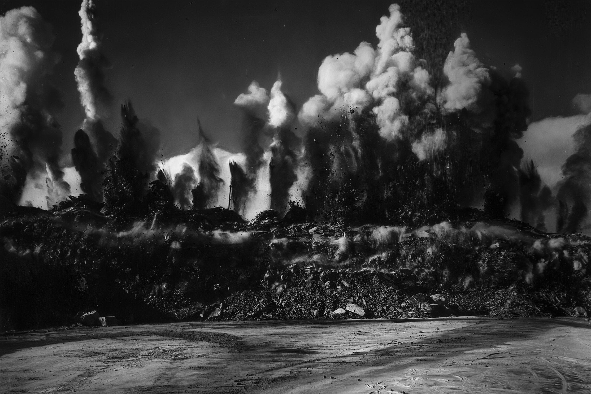
Original photos of the mine courtesy the Marmora Historical Society and H.R. Oakman, showing blasting in the early days and lower development in the seventies.
Visit the Marmora Historical Soc. for a full history of the Mighty Marmoraton Mine.
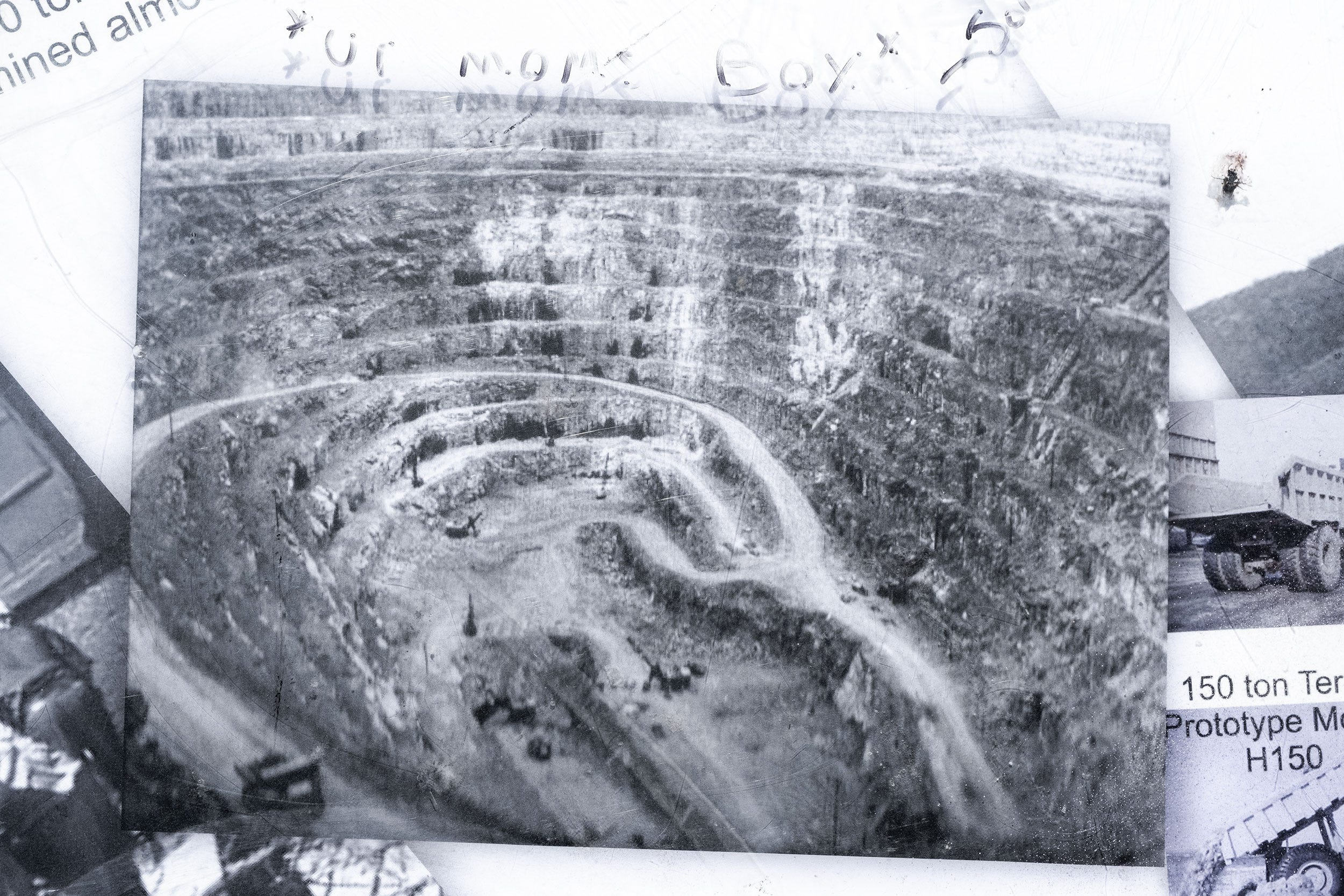
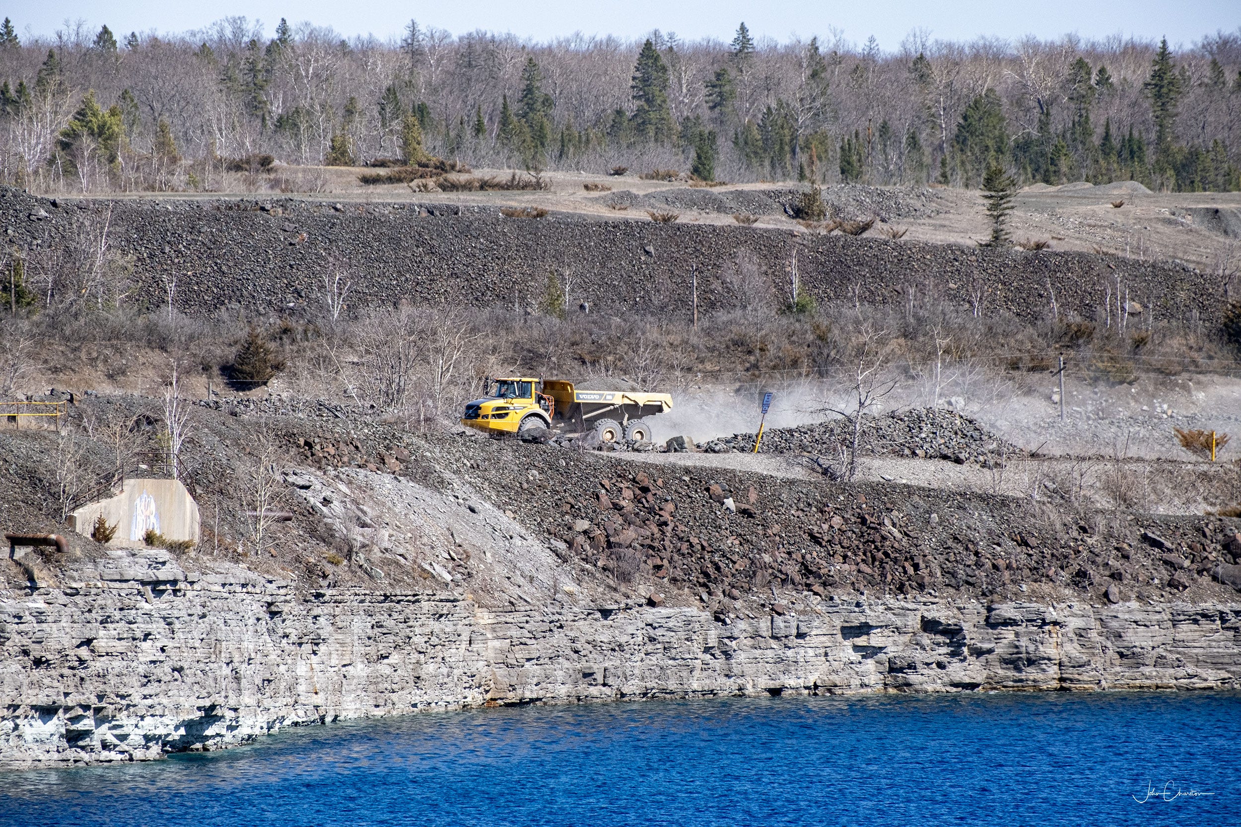
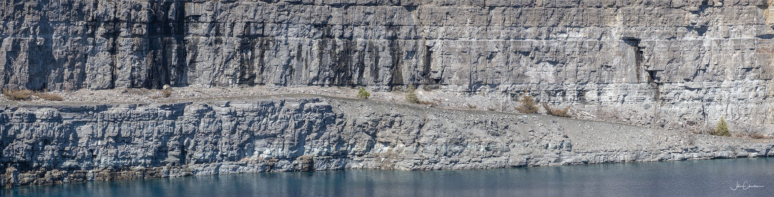
The pit is 2800 feet long and 1500 feet wide, with a depth of 700 feet. Trucks followed an average 10% grade around the circular haulage road.
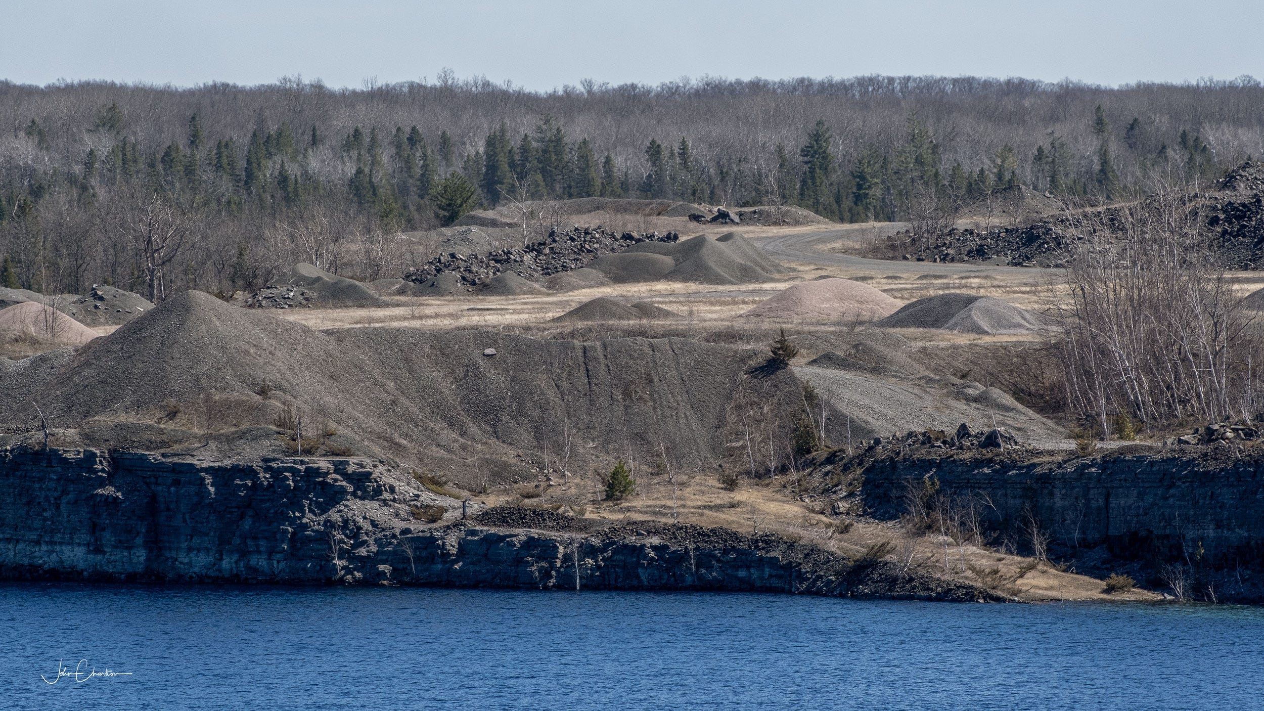
Three and a half million gallons of water were pumped from mine each week. Following closure, it gradually filling up.
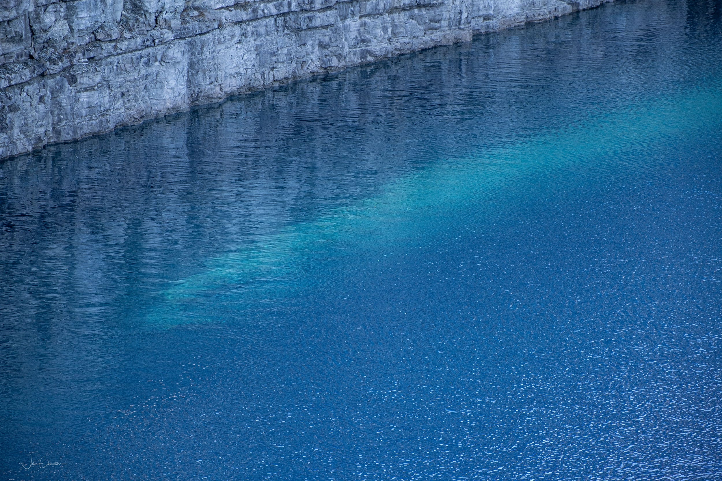
The crystal clear water reveals few features beneath its surface save for close to the edge where lighter coloured rock can easily be seen from above.

The highest land mass at the west end of the pit remains visible above the water as seen below. A walking trail is visible, but is inaccessible to the public. In fact, except for a hole in the perimeter fence near the sole observation area, the mine is closed off to the public. Most of the images shown here were only possible by passing beyond that breach in the fence.
New life as a major renewable energy storage project?
If thinking about all of this large scale industrial activity has you feeling uneasy, let me tell you one more thing about the site. It has the potential to become a renewable resource producing enough hydroelectricity to power 400,000 homes for up to 5 hours during peak electricity demand. The idea is to build a smaller second reservoir south of the pit from the slag heaps there and pump water out of the mine into that holding tank when demand is low, then when demand rises, flushing the water down to the base of the mine using gravity, harvesting electrical power in the process.
Read about the project in The Narwhal. See Big pit energy: an old mine could bring renewables and new life to an eastern Ontario town - Long an open crater, the former Marmoraton mine may become a hydroelectric battery surrounded by a rewilded outdoor recreation site.
Update: I encourage readers to visit the comments section below to read more about the fate of this particular energy storage project and how newer tech solutions are moving away from electrical storage that requires large scale mechanical components.
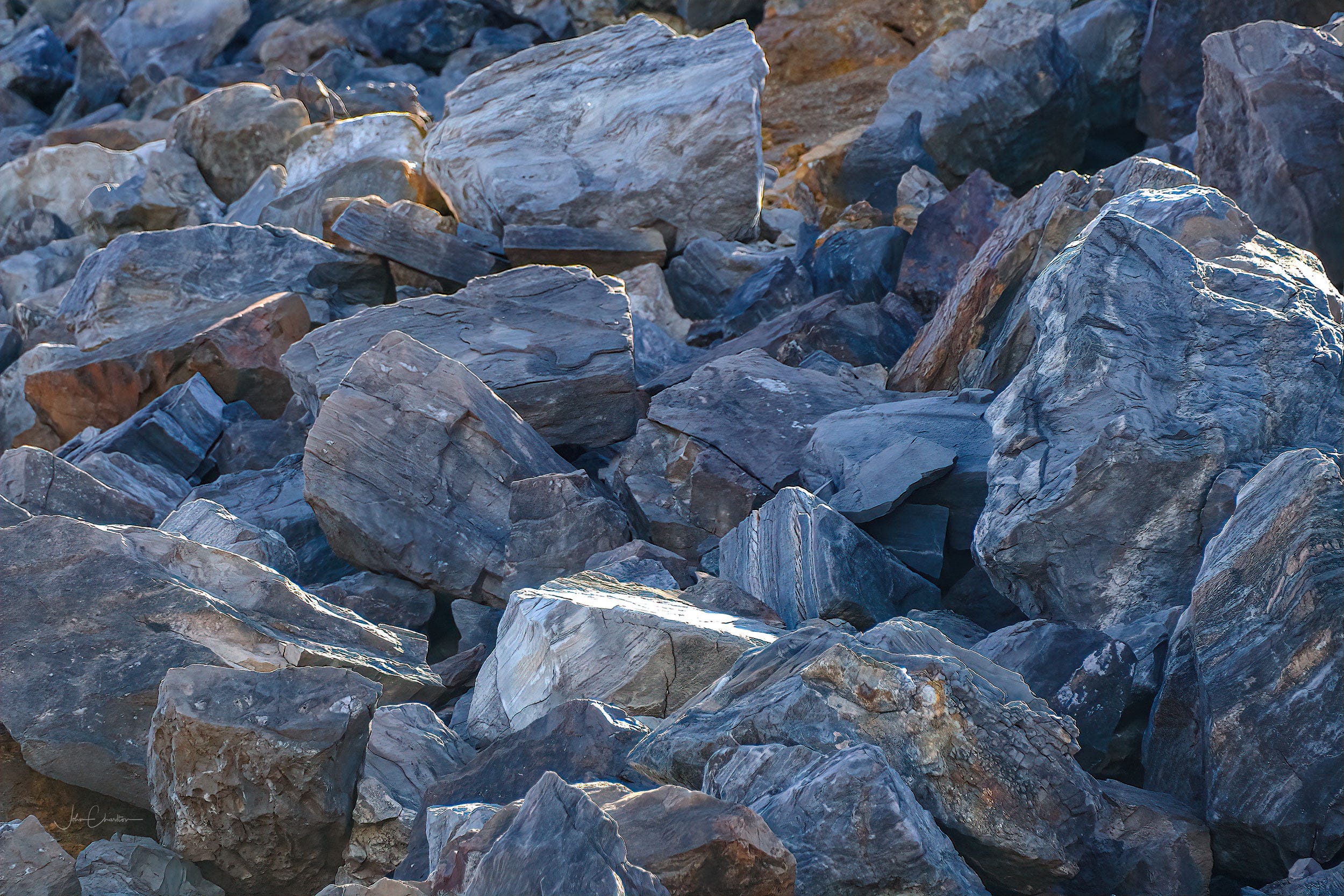
Rock of Ages
While walking near the foot of the large slag heap on the south side of the pit, I looked up to see this face in the rocks. A big boulder actually, and I wondered how long this rock face, ripped from the ground, had been sitting there staring out at the pit, a silent witness to its watery transition.
So, has man finished with this giant disturbance of the natural order of things or will they be back? Perhaps the time for renewable energy project’s like this has come.

That’s it for my visit to the mine. Thank you for reading My Photo Journal. I really appreciate you stopping by and having a look. Please feel free to leave a comment below. Have you ever visited a mine site?
As usual, I’ll leave you with a tune. This one is Rock of Ages by Grant Lee Buffalo.
My parents took us as kids to this site for the first time back in 1988. It seems to me there was at least 5 or 6 visible courses around the pit at that time, with phone poles descending down beneath. The water was quite low, and remember my older brother throwing a big rock and losing sight of it from the side. Great memories
What an interesting experience John. I've only visited a mine in Nova Scotia that was enclosed . The water looks beautiful in the pit. Hopefully it can be put to good use by generating power in the near future. Thank you once again for an enlightening post about our unique area that we live in.